
The planning and maintenance of complex infrastructure today requires more than just two-dimensional CAD drawings. The Digital Twin bridges the gap between the physical and digital worlds. By creating centimeter-accurate 3D models, we enable smarter planning, seamless BIM integration, and the remote management of entire sites.
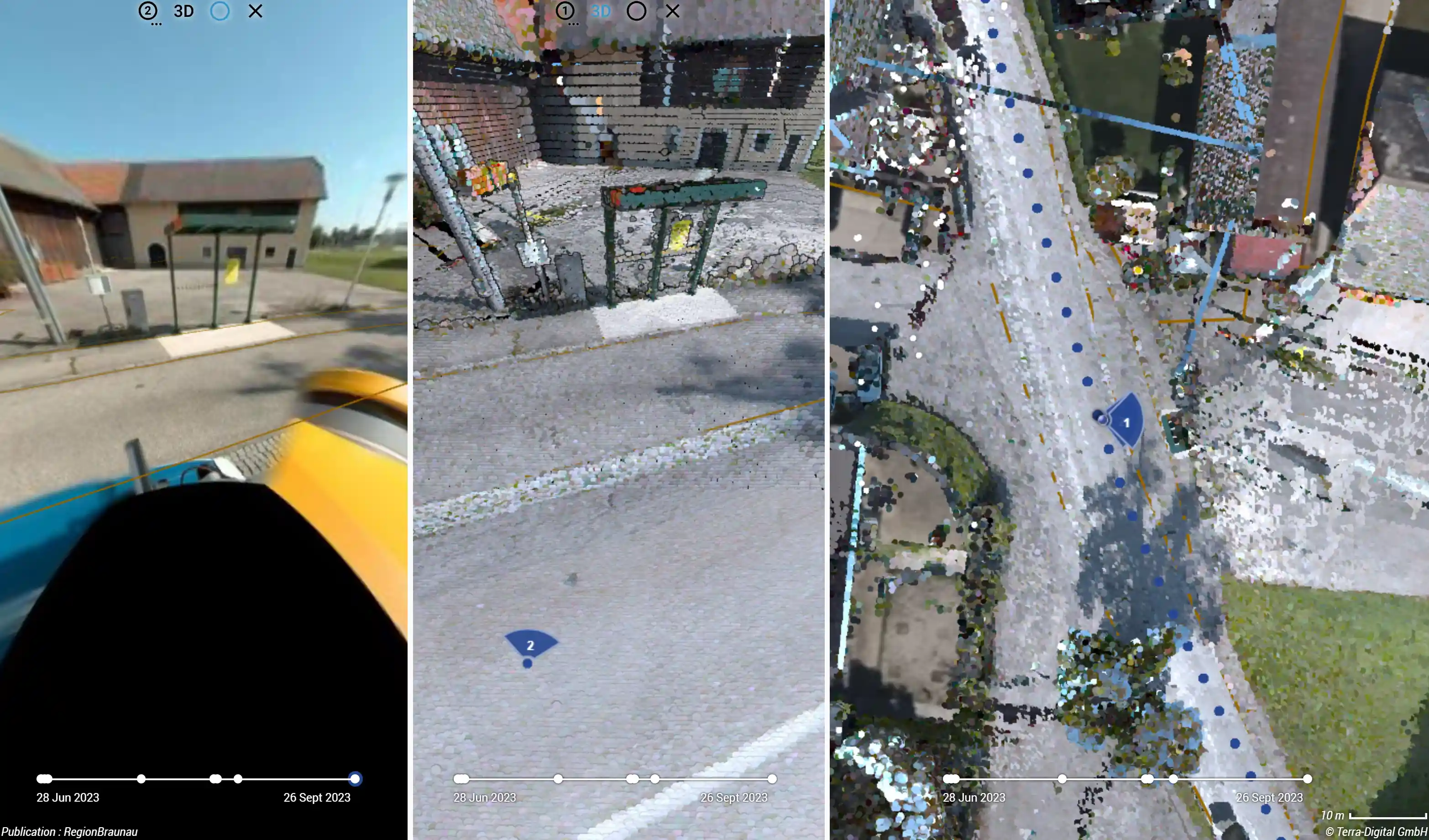
What exactly is a Digital Twin in Geomatics?
A Digital Twin is much more than just a visually appealing 3D model. It is a highly precise, data-enriched, and georeferenced replica of a physical asset. Whether dealing with an urban intersection, a factory site, or kilometer-long utility corridors – the digital twin gives engineers and project managers the ability to perform inspections, measurements, and "what-if" analyses directly from the office.
The foundation for this lies in cleaned, classified, and colorized 3D point clouds, which we deliver in industry-standard formats (.LAS, .LAZ, .E57, .RCP) and can be directly integrated into modern BIM (Building Information Modeling) workflows.
Reality Capture Technologies: How the Twin is Created
To transfer reality into the digital world with millimeter accuracy, we rely on an arsenal of state-of-the-art capture technologies:
- Vehicle-based Mobile Mapping: For large-scale urban environments, we combine high-speed LiDAR with 360-degree cameras. This allows us to capture millions of data points at normal traffic speeds – without lane closures or endangering personnel.
- UAV Drone Mapping: For expansive land areas and hard-to-reach terrain, aerial photogrammetry provides high-resolution orthomosaics and volumetric analyses.
- Handheld Site Mapper (RTK): For tight spaces or open pipe trenches, we use agile smartphone technology combined with RTK-GNSS for centimeter-accurate 3D scans in real-time. The perfect equipment for rapid as-built documentation.
Integrating the Invisible: GPR & GIS
A true Digital Twin of infrastructure doesn't stop at the surface. The decisive added value is created when above-ground 3D models merge with the underground reality.
Above Ground Meets Underground
Through the location of underground utilities using GPR (Ground Penetrating Radar), we map pipes and cables. This data is then transformed into topological, spatial databases via our GIS Digitalization and fed directly into the Digital Twin. The result is a comprehensive, holistic model of your infrastructure.
Hosting and Delivery: TerraHUB
Massive amounts of 3D point clouds and BIM models can quickly overwhelm conventional IT infrastructures. Don't have powerful CAD software? No problem.
We manage the data volumes for you and make your Digital Twin available on web-based reality viewers. Through our central spatial data portal, TerraHUB, stakeholders can easily view the 3D data via their browser, take measurements, add notes, and collaborate across multiple locations.
Future-Proof Planning Begins Today
Stop relying on scattered 2D plans and disconnected datasets. A Digital Twin reduces planning errors, accelerates approval processes, and drastically lowers long-term maintenance costs.
Ready to digitize your assets? Get in touch with our team of experts or attend our training courses to learn how you can integrate these technologies into your own workflow.